Geolocate

Banjo East topographic map

Click on the map to display elevation.

About this map

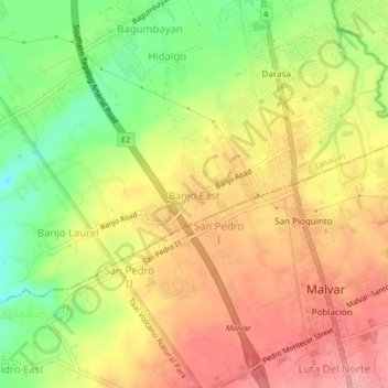
Name: Banjo East topographic map, elevation, terrain.

Location: Banjo East, Tanauan, Batangas, Calabarzon, 4232, Philippines (14.03708 121.12360 14.07708 121.16360)

Average elevation: 178 m

Minimum elevation: 120 m

Maximum elevation: 223 m

Gear up for your next adventure:

🔭Compact Binoculars - Lightweight optics for scouting trails and wildlife
🌡️Emergency Mylar Blankets - Compact thermal protection for unexpected nights outdoors
Backpacking Tent - Lightweight tent for long-distance hiking trips
🥾Hiking Boots - Sturdy boots providing ankle support and traction on rugged trails
🥾Hiking Leggings - Comfortable leggings for outdoor activities

As an Amazon Associate, this site earns from qualifying purchases at no extra cost to you.