
Make a donation
Gear up for your next adventure:
As an Amazon Associate, this site earns from qualifying purchases at no extra cost to you.
Einhausen topographic map
Click on the map to display elevation.
Make a donation
Gear up for your next adventure:
As an Amazon Associate, this site earns from qualifying purchases at no extra cost to you.
Einhausen
Die Statistisch-topographisch-historische Beschreibung des Großherzogthums Hessen schreibt 1829 über
Make a donation
Gear up for your next adventure:
As an Amazon Associate, this site earns from qualifying purchases at no extra cost to you.
About this map
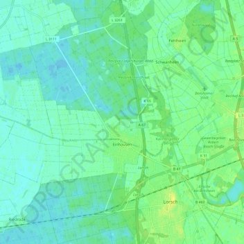
Name: Einhausen topographic map, elevation, terrain.
Location: Einhausen, Kreis Bergstraße, Hessen, 64683, Deutschland (49.64150 8.47861 49.71738 8.56939)
Average elevation: 94 m
Minimum elevation: 88 m
Maximum elevation: 104 m
Make a donation
Gear up for your next adventure:
As an Amazon Associate, this site earns from qualifying purchases at no extra cost to you.
Other topographic maps
Click on a map to view its topography, its elevation and its terrain.
Zotzenbach
Deutschland > Hessen > Kreis Bergstraße
Zotzenbach liegt beiderseits des gleichnamigen Bachs im Weschnitztal im Vorderen Odenwald ca. 30 km nördlich von Heidelberg. Es ist außer dem nahen Weiler Münschbach der einzige Ortsteil, der südlich von Rimbach-Mitte und östlich der Weschnitz liegt. Die ausgedehnte Gemarkung von Zotzenbach erstreckt sich…
Average elevation: 230 m