Geolocate

Nord topographic map

Click on the map to display elevation.

About this map

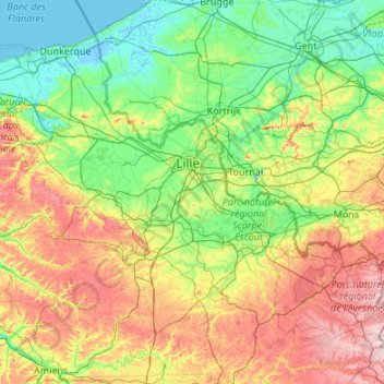
Name: Nord topographic map, elevation, terrain.

Location: Nord, Hauts-de-France, Metropolitan France, France (49.96892 2.07910 51.08899 4.23119)

Average elevation: 67 m

Minimum elevation: -4 m

Maximum elevation: 271 m

Gear up for your next adventure:

🔨Vehicle Emergency Tool - Safety tool for remote road trips to trailheads
💧Collapsible Water Bottle - Space-saving water bottle for outdoor activities
🎒Fully Waterproof Backpack - Total protection for photography gear and electronics
🥾Mountain Trail Shoes - High-traction shoes for mountain trails
🥾Waterproof Trail Shoes - Shoes designed to handle wet terrain

As an Amazon Associate, this site earns from qualifying purchases at no extra cost to you.