Geolocate

Tafton topographic map

Click on the map to display elevation.

About this map

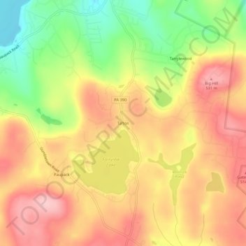
Name: Tafton topographic map, elevation, terrain.

Location: Tafton, Palmyra Township, Pike County, Pennsylvania, 18464, United States (41.38453 -75.20295 41.42453 -75.16295)

Average elevation: 458 m

Minimum elevation: 354 m

Maximum elevation: 535 m

Other topographic maps

Click on a map to view its topography, its elevation and its terrain.

Gear up for your next adventure:

🥾Waterproof Hiking Boots - Essential footwear for rugged terrain and wet Canadian trails
🔋Solar Power Bank - Keep your GPS and devices charged during long outdoor trips
🏕️Camping Hammock - Integrated protection for sleeping between trees
💧Reusable Water Bottle - Durable water bottles for hydration on trails
🛶Canoe Life Vest - Safety vest for water sports

As an Amazon Associate, this site earns from qualifying purchases at no extra cost to you.