
Bailieborough topographic map
Interactive map
Click on the map to display elevation.
About this map
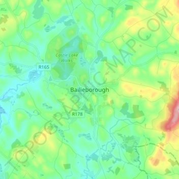
Name: Bailieborough topographic map, elevation, terrain.
Location: Bailieborough, County Cavan, Ireland (53.87686 -7.01071 53.95686 -6.93071)
Average elevation: 169 m
Minimum elevation: 115 m
Maximum elevation: 328 m