
Maple Falls topographic map
Click on the map to display elevation.
About this map
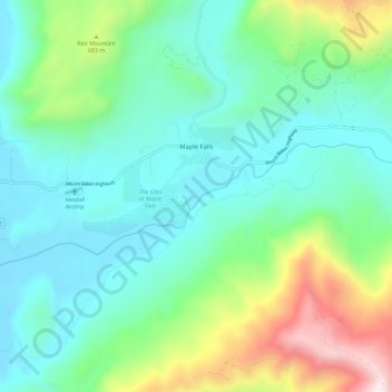
Name: Maple Falls topographic map, elevation, terrain.
Location: Maple Falls, Whatcom County, Washington, United States (48.89188 -122.14660 48.93709 -122.03118)
Average elevation: 442 m
Minimum elevation: 122 m
Maximum elevation: 1,419 m
Other topographic maps
Click on a map to view its topography, its elevation and its terrain.