Geolocate

Puntian topographic map

Click on the map to display elevation.

About this map

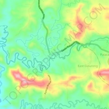
Name: Puntian topographic map, elevation, terrain.

Location: Puntian, Quezon, Bukidnon, Northern Mindanao, Philippines (7.58750 125.09323 7.62750 125.13323)

Average elevation: 299 m

Minimum elevation: 220 m

Maximum elevation: 428 m

Gear up for your next adventure:

🔨Vehicle Emergency Tool - Safety tool for remote road trips to trailheads
🥾Trail Hiking Socks - Comfortable socks to prevent blisters and fatigue
🧊Insulated Water Bottle - Keeps drinks cold in summer and prevents freezing in winter
💧Filtered Water Bottle - Safe drinking water on the go
💡LED Headlamp - Hands-free illumination for night hiking and camping

As an Amazon Associate, this site earns from qualifying purchases at no extra cost to you.