Geolocate

Hindmarsh Island topographic map

Click on the map to display elevation.

About this map

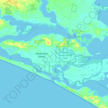
Name: Hindmarsh Island topographic map, elevation, terrain.

Location: Hindmarsh Island, Alexandrina Council, South Australia, 5214, Australia (-35.55543 138.78774 -35.48665 138.97308)

Average elevation: 4 m

Minimum elevation: -1 m

Maximum elevation: 36 m

Other topographic maps

Click on a map to view its topography, its elevation and its terrain.

Gear up for your next adventure:

🧊Portable Cooler - Keep food and drinks cold during outdoor adventures
🧳Compression Sacks - Maximize space in your backpack by shrinking gear
🥾Trail Hiking Boots - Supportive boots for rough trails
🧢Hiking Hat - Sun-protective and breathable hats for long treks
🥾All-Terrain Hiking Boots - Versatile boots for varied hiking conditions

As an Amazon Associate, this site earns from qualifying purchases at no extra cost to you.