
Stanley topographic map
Click on the map to display elevation.
Stanley
Stanley is located at 44°13′0″N 114°56′16″W / 44.21667°N 114.93778°W / 44.21667; -114.93778 (44.216698, -114.937814), at an elevation of 6,253 feet (1,906 m) above sea level
About this map
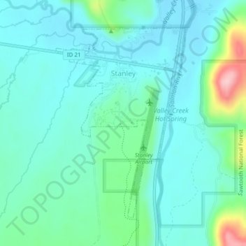
Name: Stanley topographic map, elevation, terrain.
Location: Stanley, Custer County, Idaho, United States (44.20026 -114.94822 44.22109 -114.92829)
Average elevation: 1,931 m
Minimum elevation: 1,895 m
Maximum elevation: 2,080 m