Geolocate

Baliwag topographic map

Click on the map to display elevation.

About this map

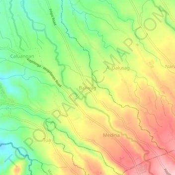
Name: Baliwag topographic map, elevation, terrain.

Location: Baliwag, Magallanes, Cavite, Calabarzon, 4124, Philippines (14.12641 120.77017 14.16641 120.81017)

Average elevation: 264 m

Minimum elevation: 170 m

Maximum elevation: 365 m

Gear up for your next adventure:

🕶️Polarized Sunglasses - Reduces glare from snow and water at high elevations
🧢Hiking Hat - Sun-protective and breathable hats for long treks
🩹Moleskin Blister Pads - Direct protection for painful foot pressure points
🦌Outdoor Trail Camera - Monitor wildlife activity near your favorite spots
🧢Outdoor Cap - Protective cap for sun and rain during hikes

As an Amazon Associate, this site earns from qualifying purchases at no extra cost to you.