Geolocate

El Bato topographic map

Click on the map to display elevation.

About this map

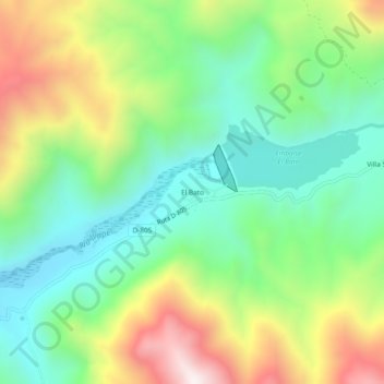
Name: El Bato topographic map, elevation, terrain.

Location: El Bato, Illapel, Provincia de Choapa, Región de Coquimbo, Chile (-31.57893 -70.89633 -31.53893 -70.85633)

Average elevation: 1,090 m

Minimum elevation: 778 m

Maximum elevation: 1,638 m

Other topographic maps

Click on a map to view its topography, its elevation and its terrain.

Gear up for your next adventure:

🧴Insect Repellent - Protect yourself from bugs during outdoor adventures
🥾Hiking Gaiters - Protect legs and shoes from mud, snow, and debris
🪜Heavy Duty Carabiners - Multi-use clips for securing gear to your backpack
🧣Evaporative Cooling Towel - Beat the heat during intense summer climbs
🔭Outdoor Binoculars - Lightweight binoculars for birdwatching and hiking

As an Amazon Associate, this site earns from qualifying purchases at no extra cost to you.