
Treemont topographic map
Click on the map to display elevation.
About this map
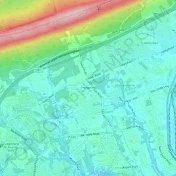
Name: Treemont topographic map, elevation, terrain.
Average elevation: 162 m
Minimum elevation: 98 m
Maximum elevation: 358 m
Other topographic maps
Click on a map to view its topography, its elevation and its terrain.
Enola
United States > Pennsylvania > Cumberland County > East Pennsboro Township > Enola
Average elevation: 119 m
West Fairview
United States > Pennsylvania > Cumberland County > East Pennsboro Township > West Fairview
Average elevation: 105 m