
Thank you for supporting this site ❤️
Make a donation
Make a donation
Gear up for your next adventure:
As an Amazon Associate, this site earns from qualifying purchases at no extra cost to you.
Motanwadi topographic map
Click on the map to display elevation.
Thank you for supporting this site ❤️
Make a donation
Make a donation
Gear up for your next adventure:
As an Amazon Associate, this site earns from qualifying purchases at no extra cost to you.
About this map
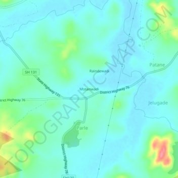
Name: Motanwadi topographic map, elevation, terrain.
Location: Motanwadi, Parle, Chandgad, Kolhapur, Maharashtra, India (15.84522 74.18568 15.88522 74.22568)
Average elevation: 713 m
Minimum elevation: 696 m
Maximum elevation: 780 m
Thank you for supporting this site ❤️
Make a donation
Make a donation
Gear up for your next adventure:
As an Amazon Associate, this site earns from qualifying purchases at no extra cost to you.