Geolocate

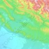
Dādāmandi topographic map

Click on the map to display elevation.

About this map

Name: Dādāmandi topographic map, elevation, terrain.

Location: Dādāmandi, Kotdwara, Pauri Garhwal District, Uttarakhand, 246124, India (29.84464 78.59092 29.88464 78.63092)

Average elevation: 1,032 m

Minimum elevation: 837 m

Maximum elevation: 1,354 m

Other topographic maps

Click on a map to view its topography, its elevation and its terrain.

Corbett Tiger Reserve

India > Uttarakhand > Kotdwara

Average elevation: 632 m

Ramganga Dam

India > Uttarakhand > Kotdwara

The dam is a 128 m (420 ft) tall and 630 m (2,067 ft) long earth and rock-fill embankment dam with 10,000,000 m3 (13,079,506 cu yd) of fill. The dam's spillway is controlled by five gates and has a maximum discharge of 8,467 m3/s (299,009 cu ft/s). To support the reservoir's elevation, there is a 72 m (236 ft)…

Average elevation: 389 m
Jim Corbett National Park

India > Uttarakhand > Kotdwara

Average elevation: 559 m

Jim Corbett National Park

India > Uttarakhand > Kotdwara

Average elevation: 559 m

Jim Corbett National Park

India > Uttarakhand > Kotdwara

Average elevation: 559 m

Jim Corbett National Park

India > Uttarakhand > Kotdwara

Average elevation: 559 m

Gear up for your next adventure:

🧤Insulated Winter Gloves - Heavy-duty protection for sub-zero Canadian adventures
🥘Camping Cookware Set - Compact nesting pots and pans for trail cooking
💧Hydration Bladder - Hands-free hydration solution for long treks
🔦LED Headtorch - Bright and durable light for night activities
🧥Waterproof Pants - Keep dry during rainy hiking conditions

As an Amazon Associate, this site earns from qualifying purchases at no extra cost to you.