Geolocate

Mazé topographic map

Click on the map to display elevation.

About this map
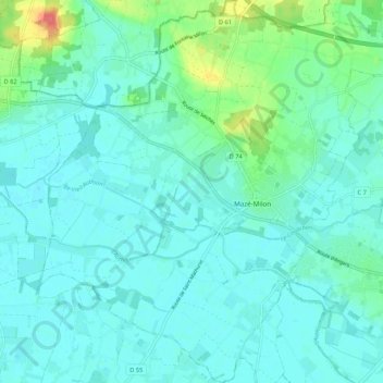
Name: Mazé topographic map, elevation, terrain.

Location: Mazé, Mazé-Milon, Saumur, Maine-et-Loire, Pays de la Loire, France métropolitaine, 49630, France (47.42162 -0.33254 47.49372 -0.23192)

Average elevation: 25 m

Minimum elevation: 15 m

Maximum elevation: 70 m

Other topographic maps

Click on a map to view its topography, its elevation and its terrain.
Gear up for your next adventure:

🕯️Camping Lantern - Illuminates your entire campsite with high-efficiency LEDs
💡Portable Camping Lamp - Rechargeable lamp for campsite lighting
🔭Outdoor Binoculars - Lightweight binoculars for birdwatching and hiking
🛌Insulated Sleeping Pad - Critical thermal barrier between you and the cold ground
🎒Backpack Rain Cover - External shield to keep your entire pack dry

As an Amazon Associate, this site earns from qualifying purchases at no extra cost to you.