Geolocate

Labrot topographic map

Click on the map to display elevation.

About this map
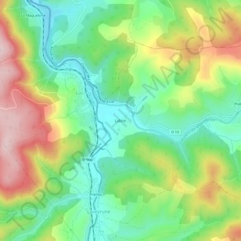
Name: Labrot topographic map, elevation, terrain.

Location: Labrot, Saint-Étienne-de-Lugdarès, Largentière, Ardèche, Auvergne-Rhône-Alpes, France métropolitaine, 07590, France (44.62709 3.88012 44.66709 3.92012)

Average elevation: 1,061 m

Minimum elevation: 945 m

Maximum elevation: 1,240 m

Other topographic maps

Click on a map to view its topography, its elevation and its terrain.
Gear up for your next adventure:

🥾Trail Hiking Shoes - Durable shoes designed for rugged trails
🥾Trail Hiking Boots - Supportive boots for rough trails
🧥Waterproof Hiking Jacket - Protect yourself from rain and wind while hiking
🧭GPS Outdoor Watch - Smart watch for navigation and fitness tracking in nature
🚲Heavy Duty Bike Lock - Secure your bike at the trailhead or during stops

As an Amazon Associate, this site earns from qualifying purchases at no extra cost to you.