
Stoney Hill Regional Park topographic map
Interactive map
Click on the map to display elevation.
About this map
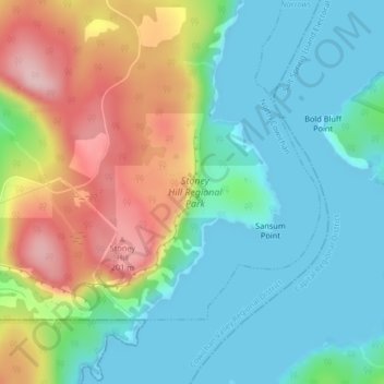
Name: Stoney Hill Regional Park topographic map, elevation, terrain.
Average elevation: 73 m
Minimum elevation: -1 m
Maximum elevation: 220 m
Other topographic maps
Click on a map to view its topography, its elevation and its terrain.
Quamichan Lake
Canada > British Columbia > North Cowichan
Quamichan Lake, Stanhope Road, North Cowichan, Cowichan Valley Regional District, British Columbia, V9L 5G6, Canada
Average elevation: 40 m