Geolocate

Coat Carric topographic map

Click on the map to display elevation.

About this map
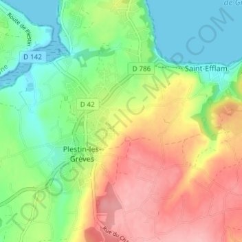
Name: Coat Carric topographic map, elevation, terrain.

Location: Coat Carric, Saint-Efflam, Plestin-les-Grèves, Lannion, Côtes-d'Armor, Bretagne, France métropolitaine, 22310, France (48.63999 -3.64196 48.67999 -3.60196)

Average elevation: 53 m

Minimum elevation: -1 m

Maximum elevation: 124 m

Other topographic maps

Click on a map to view its topography, its elevation and its terrain.

Gear up for your next adventure:

🧥Waterproof Jacket - Lightweight rain jackets for hiking and outdoor activities
🧢Sun Hat - Wide-brim hat for sun protection
🥾Trail Running Shoes - Lightweight and durable shoes for trail running
🔋Emergency Crank Radio - Weather alerts and power without needing batteries
🥾All-Terrain Hiking Boots - Versatile boots for varied hiking conditions

As an Amazon Associate, this site earns from qualifying purchases at no extra cost to you.