Geolocate

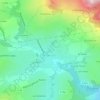
Les Giffards topographic map

Click on the map to display elevation.

About this map

Name: Les Giffards topographic map, elevation, terrain.

Location: Les Giffards, Novalaise, Chambéry, Savoie, Auvergne-Rhône-Alpes, France métropolitaine, 73470, France (45.57900 5.76686 45.61900 5.80686)

Average elevation: 663 m

Minimum elevation: 378 m

Maximum elevation: 1,437 m

Other topographic maps

Click on a map to view its topography, its elevation and its terrain.
73470

France > Auvergne-Rhône-Alpes > Savoie > Novalaise > Carabin

Average elevation: 491 m

Gear up for your next adventure:

🔦LED Flashlight - Powerful and long-lasting flashlight for camping and emergencies
🧣Evaporative Cooling Towel - Beat the heat during intense summer climbs
🛌Down Sleeping Bag - Superior warmth-to-weight ratio for cold nights
🏃Hydration Running Vest - Carry water and maps close to your body for speed
🕶️Polarized Sunglasses - Reduces glare from snow and water at high elevations

As an Amazon Associate, this site earns from qualifying purchases at no extra cost to you.