Geolocate

Les Boursis topographic map

Click on the map to display elevation.

About this map

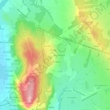
Name: Les Boursis topographic map, elevation, terrain.

Location: Les Boursis, Bort-l'Étang, Thiers, Puy-de-Dôme, Auvergne-Rhône-Alpes, France métropolitaine, 63190, France (45.77493 3.39831 45.81493 3.43831)

Average elevation: 377 m

Minimum elevation: 318 m

Maximum elevation: 472 m

Other topographic maps

Click on a map to view its topography, its elevation and its terrain.

Gear up for your next adventure:

🧦Crew Hiking Socks - Comfortable socks for long-distance hikes
Tent Footprint - Protect tent floor and increase durability
🛁Quick-Dry Microfiber Towel - Space-saving towel that dries rapidly on the move
🧴First Aid Kit - Essential first aid supplies for outdoor emergencies
👟Trail Running Shoes - Agile footwear for fast-paced topographic exploration

As an Amazon Associate, this site earns from qualifying purchases at no extra cost to you.