Geolocate

Morgarten topographic map

Click on the map to display elevation.

About this map

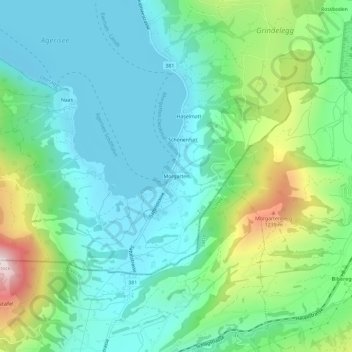
Name: Morgarten topographic map, elevation, terrain.

Location: Morgarten, Oberägeri, Zug, 6315, Switzerland (47.08451 8.62153 47.12451 8.66153)

Average elevation: 892 m

Minimum elevation: 715 m

Maximum elevation: 1,407 m

Gear up for your next adventure:

💡Portable Camping Lamp - Rechargeable lamp for campsite lighting
🧦Outdoor Socks - Durable socks designed for hiking and outdoor sports
🥾Lightweight Hiking Boots - Boots for comfort and mobility on long hikes
🥾Hiking Shorts - Breathable shorts suitable for summer hikes
🧊Portable Cooler - Keep food and drinks cold during outdoor adventures

As an Amazon Associate, this site earns from qualifying purchases at no extra cost to you.