Geolocate

Hindi topographic map

Click on the map to display elevation.

About this map
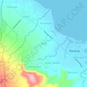
Name: Hindi topographic map, elevation, terrain.

Location: Hindi, Bacacay, Albay, Bicol Region, 4514, Philippines (13.27594 123.75656 13.31594 123.79656)

Average elevation: 40 m

Minimum elevation: -2 m

Maximum elevation: 203 m

Other topographic maps

Click on a map to view its topography, its elevation and its terrain.

Pinamuntugan Island

Philippines > Albay > Bacacay > Busdac

Average elevation: 8 m

Sula Island

Philippines > Albay > Bacacay > Nahapunan

Average elevation: 13 m

Pinamuntugan Island

Philippines > Albay > Bacacay > Busdac

Average elevation: 8 m

Gear up for your next adventure:

🥾Waterproof Hiking Boots - Essential footwear for rugged terrain and wet Canadian trails
🥫Freeze-Dried Meals - Lightweight, high-calorie nutrition for multi-day treks
🧤Thermal Hiking Gloves - Grip-enhanced gloves for cold-weather altitude trekking
💡Portable Camping Lamp - Rechargeable lamp for campsite lighting
🧭GPS Tracker - Track your location in remote areas safely

As an Amazon Associate, this site earns from qualifying purchases at no extra cost to you.