Geolocate

Chandragiri topographic map

Click on the map to display elevation.

About this map

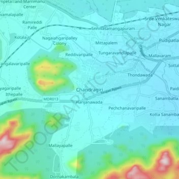
Name: Chandragiri topographic map, elevation, terrain.

Location: Chandragiri, Tirupati, Andhra Pradesh, 517100, India (13.54425 79.27667 13.62425 79.35667)

Average elevation: 254 m

Minimum elevation: 172 m

Maximum elevation: 788 m

Gear up for your next adventure:

💧Reusable Water Bottle - Durable water bottles for hydration on trails
Camping Tent - Weather-resistant tents suitable for 2 to 6 people
🥫Freeze-Dried Meals - Lightweight, high-calorie nutrition for multi-day treks
🔭Compact Binoculars - Lightweight optics for scouting trails and wildlife
🧥Thermal Fleece Jacket - Versatile insulation for changing mountain temperatures

As an Amazon Associate, this site earns from qualifying purchases at no extra cost to you.