
Tapachula topographic map
Click on the map to display elevation.
Tapachula
The cuisine of the municipality varies greatly as the topography extends from the ocean into the mountains. Main annual events include Chinese New Year, San Benito, the Feria Tapachula, San Agustín, Jesús de la Buena Esperanza and San Miguel.
About this map
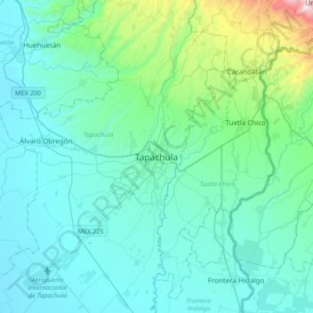
Name: Tapachula topographic map, elevation, terrain.
Location: Tapachula, Chiapas, 30830, Mexico (14.74429 -92.42093 15.06429 -92.10093)
Average elevation: 202 m
Minimum elevation: 3 m
Maximum elevation: 1,529 m