
Thank you for supporting this site ❤️
Make a donation
Make a donation
Gear up for your next adventure:
As an Amazon Associate, this site earns from qualifying purchases at no extra cost to you.
Kavalapur topographic map
Click on the map to display elevation.
Thank you for supporting this site ❤️
Make a donation
Make a donation
Gear up for your next adventure:
As an Amazon Associate, this site earns from qualifying purchases at no extra cost to you.
About this map
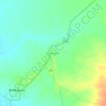
Name: Kavalapur topographic map, elevation, terrain.
Location: Kavalapur, Miraj, Sangli District, Maharashtra, 416304, India (16.90196 74.59365 16.94196 74.63365)
Average elevation: 571 m
Minimum elevation: 556 m
Maximum elevation: 599 m
Thank you for supporting this site ❤️
Make a donation
Make a donation
Gear up for your next adventure:
As an Amazon Associate, this site earns from qualifying purchases at no extra cost to you.