Geolocate

Futian topographic map

Click on the map to display elevation.

About this map

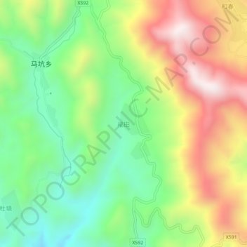
Name: Futian topographic map, elevation, terrain.

Location: Futian, Hua'an County, Zhangzhou City, Fujian, China (24.93027 117.34537 24.97027 117.38537)

Average elevation: 896 m

Minimum elevation: 556 m

Maximum elevation: 1,355 m

Gear up for your next adventure:

👖Convertible Hiking Pants - Zip-off legs to adapt to changing weather conditions
🧭Orienteering Kit - Tools for map reading and navigation in the wild
🪑Insulated Seat Pad - Protect your seat from cold rocks and wet logs
🧦Outdoor Socks - Durable socks designed for hiking and outdoor sports
🧢Hiking Sun Hat - Wide-brimmed protection for exposed mountain ridges

As an Amazon Associate, this site earns from qualifying purchases at no extra cost to you.