Geolocate

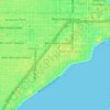
Meadow Brook topographic map

Click on the map to display elevation.

About this map

Name: Meadow Brook topographic map, elevation, terrain.

Location: Meadow Brook, Hillsborough County, Florida, 33635, United States (28.01213 -82.61823 28.05213 -82.57823)

Average elevation: 7 m

Minimum elevation: 0 m

Maximum elevation: 11 m

Other topographic maps

Click on a map to view its topography, its elevation and its terrain.
Lutz

United States > Florida > Hillsborough County

Average elevation: 21 m

Lake Park

United States > Florida > Hillsborough County > Lutz

Average elevation: 19 m

Boyette

United States > Florida > Hillsborough County > Boyette

Average elevation: 21 m

Cheval

United States > Florida > Hillsborough County

Average elevation: 20 m

Gear up for your next adventure:

⛺Backpacking Tent - Lightweight tent for long-distance hiking trips
🧦Hiking Socks - Moisture-wicking and comfortable socks for long hikes
🗺️Topographic Maps - Detailed maps to explore trails, mountains, and wilderness areas
💧Hydration Bladder - Hands-free hydration solution for long treks
🥾Hiking Shorts - Breathable shorts suitable for summer hikes

As an Amazon Associate, this site earns from qualifying purchases at no extra cost to you.