Geolocate

Transtrand topographic map

Click on the map to display elevation.

About this map

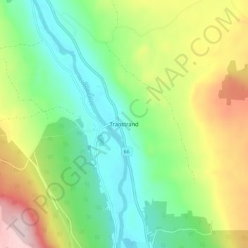
Name: Transtrand topographic map, elevation, terrain.

Location: Transtrand, Malung-Sälens kommun, Dalarna County, Sweden (61.07037 13.30171 61.11037 13.34171)

Average elevation: 438 m

Minimum elevation: 340 m

Maximum elevation: 607 m

Other topographic maps

Click on a map to view its topography, its elevation and its terrain.

Malung-Sälens kommun

Sweden > Dalarna County

Average elevation: 395 m

Gear up for your next adventure:

Camping Tent - Weather-resistant tents suitable for 2 to 6 people
📷Outdoor Action Camera - Capture high-elevation views and rugged adventures
🧤Rechargeable Heated Gloves - Extreme warmth for Canadian winter expeditions
🧤Insulated Winter Gloves - Heavy-duty protection for sub-zero Canadian adventures
🦟Insect Repellent - Keep mosquitoes and black flies away in wooded areas

As an Amazon Associate, this site earns from qualifying purchases at no extra cost to you.