Geolocate

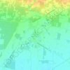
Caianello topographic map

Click on the map to display elevation.

About this map

Name: Caianello topographic map, elevation, terrain.

Location: Caianello, Caserta, Campania, 81059, Italia (41.28560 14.03293 41.32150 14.12222)

Average elevation: 206 m

Minimum elevation: 133 m

Maximum elevation: 452 m

Other topographic maps

Click on a map to view its topography, its elevation and its terrain.

Destra Volturno

Italia > Campania > Caserta > Castel Volturno

Average elevation: 1 m

Borgo Appio

Italia > Campania > Caserta > Grazzanise

Average elevation: 8 m

Sant'Andrea del Pizzone

Italia > Campania > Caserta

Average elevation: 15 m

Casola

Italia > Campania > Caserta > Caserta

Average elevation: 317 m

Pugliano

Italia > Campania > Caserta > Teano

Average elevation: 189 m

Sant'Agata

Italia > Campania > Caserta > Sessa Aurunca > Avezzano-Sorbello

Average elevation: 190 m

Vallelunga

Italia > Campania > Caserta > Gallo Matese

Average elevation: 783 m

Sepicciano

Italia > Campania > Caserta > Piedimonte Matese > Sepicciano

Average elevation: 315 m

Pellegrino

Italia > Campania > Caserta > Pontelatone

Average elevation: 194 m

Mezzano

Italia > Campania > Caserta > Caserta

Average elevation: 207 m

Gear up for your next adventure:

🔭Compact Binoculars - Lightweight optics for scouting trails and wildlife
💡LED Camping Lantern - Illuminate your campsite with long-lasting lanterns
🔥Emergency Fire Starter - Reliable ignition source for all weather conditions
🦟Insect Repellent - Keep mosquitoes and black flies away in wooded areas
❄️Traction Ice Cleats - Slip-on spikes for icy trails and winter hiking

As an Amazon Associate, this site earns from qualifying purchases at no extra cost to you.