Geolocate

Alabaster topographic map

Click on the map to display elevation.

About this map

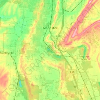
Name: Alabaster topographic map, elevation, terrain.

Location: Alabaster, Shelby County, Alabama, 35007, United States (33.16637 -86.87878 33.27176 -86.74398)

Average elevation: 173 m

Minimum elevation: 84 m

Maximum elevation: 291 m

Gear up for your next adventure:

🦌Outdoor Trail Camera - Monitor wildlife activity near your favorite spots
🧦Hiking Socks - Moisture-wicking and comfortable socks for long hikes
🧣Merino Neck Gaiter - Protects against wind, sun, and cold at high altitudes
🧼Travel Hand Sanitizer - Keep hands clean when water is scarce
🩹Compact First Aid Kit - Pre-packed essentials for common trail injuries

As an Amazon Associate, this site earns from qualifying purchases at no extra cost to you.