Geolocate

Iona topographic map

Click on the map to display elevation.

About this map
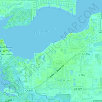
Name: Iona topographic map, elevation, terrain.

Location: Iona, Lee County, Florida, United States (26.49185 -81.99733 26.54384 -81.92529)

Average elevation: 2 m

Minimum elevation: -1 m

Maximum elevation: 9 m

Other topographic maps

Click on a map to view its topography, its elevation and its terrain.
Sanibel Island

United States > Florida > Lee County > Sanibel

Average elevation: 1 m

North Fort Myers

United States > Florida > Lee County

Average elevation: 4 m

Seasons

United States > Florida > Lee County > Bonita Springs

Average elevation: 6 m

Palmesta

United States > Florida > Lee County > Bonita Springs

Average elevation: 5 m

Gear up for your next adventure:

💧Hydration Pack - Hands-free hydration system for long hikes
🥾Mountain Hiking Shoes - Shoes with superior grip for mountainous terrain
🥾All-Terrain Hiking Boots - Versatile boots for varied hiking conditions
🥾Hiking Leggings - Comfortable leggings for outdoor activities
🧥Packable Rain Jacket - Breathable waterproof layer for unpredictable weather

As an Amazon Associate, this site earns from qualifying purchases at no extra cost to you.