
Reserva de la biosfera Visis-Cabá topographic map
Interactive map
Click on the map to display elevation.
About this map
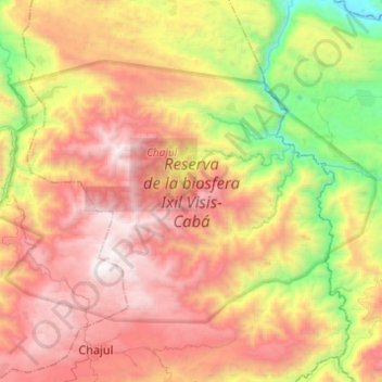
Name: Reserva de la biosfera Visis-Cabá topographic map, elevation, terrain.
Location: Reserva de la biosfera Visis-Cabá, Chajul, Quiché, Guatemala (15.50089 -91.10141 15.66310 -90.85668)
Average elevation: 1,487 m
Minimum elevation: 269 m
Maximum elevation: 2,682 m