Geolocate

Alpe Cleva Bella topographic map

Click on the map to display elevation.

About this map

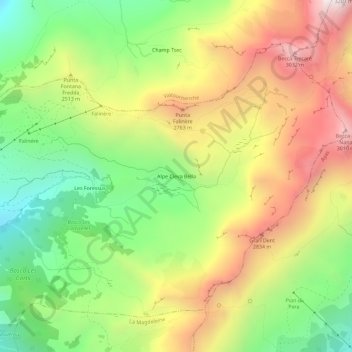
Name: Alpe Cleva Bella topographic map, elevation, terrain.

Location: Alpe Cleva Bella, Chamois, Aosta Valley, Italy (45.82394 7.63698 45.86394 7.67698)

Average elevation: 2,413 m

Minimum elevation: 1,827 m

Maximum elevation: 3,107 m

Gear up for your next adventure:

🥾Trekking Boots - Durable boots for long-distance trekking
🧭GPS Outdoor Watch - Smart watch for navigation and fitness tracking in nature
🧢Sun Protection Cap - Breathable cap to protect from sun exposure
🥾Trail Running Shoes - Lightweight and durable shoes for trail running
🥽Outdoor Goggles - Protective eyewear for outdoor activities

As an Amazon Associate, this site earns from qualifying purchases at no extra cost to you.