Geolocate

Macon topographic map

Click on the map to display elevation.

About this map

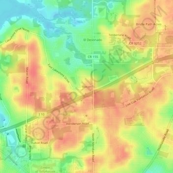
Name: Macon topographic map, elevation, terrain.

Location: Macon, Leon County, Florida, 32303, United States (30.47464 -84.29907 30.51464 -84.25907)

Average elevation: 56 m

Minimum elevation: 23 m

Maximum elevation: 80 m

Other topographic maps

Click on a map to view its topography, its elevation and its terrain.

Woodville

United States > Florida > Leon County > Woodville

Average elevation: 10 m

Gear up for your next adventure:

🏃Hydration Running Vest - Carry water and maps close to your body for speed
Bushcraft Tarp - Versatile emergency shelter or gear protection
🦶Anti-Blister Balm - Prevents friction and hotspots during long ascents
🛰️Satellite Messenger - Emergency communication for areas with no cell service
🧤Thermal Hiking Gloves - Grip-enhanced gloves for cold-weather altitude trekking

As an Amazon Associate, this site earns from qualifying purchases at no extra cost to you.