Geolocate

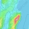
Val Mara topographic map

Click on the map to display elevation.

About this map

Name: Val Mara topographic map, elevation, terrain.

Location: Val Mara, Circolo del Ceresio, Distretto di Lugano, Ticino, Switzerland (45.90872 8.96437 45.94630 9.02246)

Average elevation: 797 m

Minimum elevation: 261 m

Maximum elevation: 1,677 m

Other topographic maps

Click on a map to view its topography, its elevation and its terrain.
Pazzallo

Switzerland > Ticino > Distretto di Lugano > Lugano

Average elevation: 366 m

Brè

Switzerland > Ticino > Distretto di Lugano > Lugano

Average elevation: 564 m

Gear up for your next adventure:

🩹Compact First Aid Kit - Pre-packed essentials for common trail injuries
🥾Approach Shoes - Shoes designed for climbing approaches and rugged trails
🦶Hiking Shoe Insoles - Added support for high arches and long days on feet
🥾Trail Running Shoes - Lightweight and durable shoes for trail running
🦯Trekking Poles - Reduced impact on joints for steep topographic climbs

As an Amazon Associate, this site earns from qualifying purchases at no extra cost to you.