Geolocate

Tukkuguda topographic map

Click on the map to display elevation.

About this map

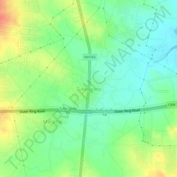
Name: Tukkuguda topographic map, elevation, terrain.

Location: Tukkuguda, Maheswaram mandal, Ranga Reddy, Telangana, India (17.18904 78.45678 17.22904 78.49678)

Average elevation: 589 m

Minimum elevation: 568 m

Maximum elevation: 621 m

Gear up for your next adventure:

Bushcraft Tarp - Versatile emergency shelter or gear protection
🧥Waterproof Pants - Keep dry during rainy hiking conditions
🛌Down Sleeping Bag - Superior warmth-to-weight ratio for cold nights
🛏️Sleeping Bag - Warm and compact sleeping bags for outdoor camping
🔭Compact Binoculars - Lightweight optics for scouting trails and wildlife

As an Amazon Associate, this site earns from qualifying purchases at no extra cost to you.