
Make a donation
Gear up for your next adventure:
As an Amazon Associate, this site earns from qualifying purchases at no extra cost to you.
Kallooppara topographic map
Click on the map to display elevation.
Make a donation
Gear up for your next adventure:
As an Amazon Associate, this site earns from qualifying purchases at no extra cost to you.
Kallooppara
The old Vemolinad was separated into "Vadakumkoor" and "Thekkumkoor" in AD 1100. Kottayam, Chenganacherry, Thiruvalla, Kanjirapally and some places of high range were included in Thekkumkoor kingdom. Kallooppara was under the control of the Thekkumkoor dynasty. It had Kalari (training center for martial arts) at Kallooppara. The famous Kalari was known as Thekkumkoor fort which existed until recently. The Thekkumkoor army camped here and it was risky for the enemy to attack them. It is said that the King had many close friends in Kallooppara and its surroundings. The Old Nair lord Family at Koipuram in Eraviperoor was in close touch with the Kings. It was this Nair Lord family who had great influence on the king and inspired him to donate Kallooppara sub-division to Edappally dynasty. As the withdrawal of Thekkumkoor kings, Kallooppara came under the Edappally dynasty, which is also known as Elangalloor Swaroopam. The Edappally dynasty has the history of elevation of a temple priest to the royal position of a King. The founder of the Edappally dynasty was a priest of Thrikkakara temple according to the historical evidence and proverbs.
Make a donation
Gear up for your next adventure:
As an Amazon Associate, this site earns from qualifying purchases at no extra cost to you.
About this map
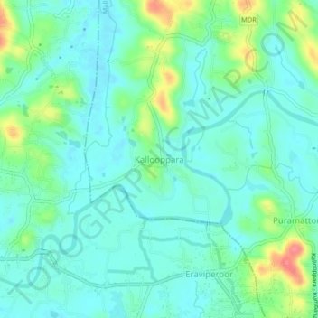
Name: Kallooppara topographic map, elevation, terrain.
Average elevation: 19 m
Minimum elevation: 0 m
Maximum elevation: 74 m
Make a donation
Gear up for your next adventure:
As an Amazon Associate, this site earns from qualifying purchases at no extra cost to you.