
Heerlen topographic map
Interactive map
Click on the map to display elevation.
About this map
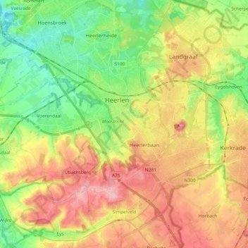
Name: Heerlen topographic map, elevation, terrain.
Location: Heerlen, Limburg, Netherlands (50.81840 5.91630 50.93422 6.02638)
Average elevation: 133 m
Minimum elevation: 62 m
Maximum elevation: 217 m
Heerlen's high elevation makes it one of the highest cities above sea level in the Netherlands.
Other topographic maps
Click on a map to view its topography, its elevation and its terrain.