Geolocate

Salisbury topographic map

Interactive map

Click on the map to display elevation.

Salisbury topographic map, elevation, terrain

Salisbury topographic map, elevation, terrain

Salisbury

According to the United States Geological Survey, Salisbury is located at an elevation of 108 feet (33 m).

Wikipedia (CC-BY-SA 3.0)

About this map

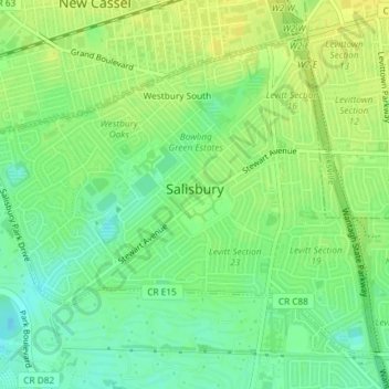
Name: Salisbury topographic map, elevation, terrain.

Location: Salisbury, Town of Hempstead, Nassau County, New York, United States (40.73379 -73.57964 40.75671 -73.54296)

Average elevation: 34 m

Minimum elevation: 23 m

Maximum elevation: 42 m

Other topographic maps

Click on a map to view its topography, its elevation and its terrain.

Woodmere

United States > New York > Nassau County

Average elevation: 5 m

Bethpage

United States > New York > Nassau County

Average elevation: 38 m

Jericho

United States > New York > Nassau County > Jericho

Average elevation: 58 m