Geolocate

Grand Rapids topographic map

Click on the map to display elevation.

About this map

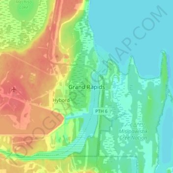
Name: Grand Rapids topographic map, elevation, terrain.

Location: Grand Rapids, Division No. 21, Manitoba, Canada (53.13477 -99.30971 53.21477 -99.22971)

Average elevation: 232 m

Minimum elevation: 214 m

Maximum elevation: 266 m

Division No. 21 trails, hiking, mountain biking, running and outdoor activities

Other topographic maps

Click on a map to view its topography, its elevation and its terrain.

Welch Lake

Canada > Manitoba > Division No. 21 > Snow Lake

Average elevation: 293 m

Gear up for your next adventure:

🧴Outdoor Sunscreen - High SPF protection for high-altitude UV exposure
🥤Collapsible Travel Cup - Saves space and weight in your mess kit
🧴First Aid Kit - Essential first aid supplies for outdoor emergencies
🛁Quick-Dry Microfiber Towel - Space-saving towel that dries rapidly on the move
🧭GPS Outdoor Watch - Smart watch for navigation and fitness tracking in nature

As an Amazon Associate, this site earns from qualifying purchases at no extra cost to you.