Geolocate

Bayasong topographic map

Click on the map to display elevation.

About this map

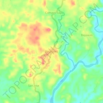
Name: Bayasong topographic map, elevation, terrain.

Location: Bayasong, Pilar, Sorsogon, Bicol Region, 4714, Philippines (12.96740 123.66343 13.00740 123.70343)

Average elevation: 32 m

Minimum elevation: -4 m

Maximum elevation: 70 m

Gear up for your next adventure:

🥾Waterproof Trail Shoes - Shoes designed to handle wet terrain
🌬️Windproof Camp Stove - Efficient cooking even on exposed mountain peaks
🥾Hiking Shoes - Durable and comfortable shoes for trail hiking
🔋Emergency Crank Radio - Weather alerts and power without needing batteries
🧭Orienteering Kit - Tools for map reading and navigation in the wild

As an Amazon Associate, this site earns from qualifying purchases at no extra cost to you.