Geolocate

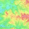
Paulhac topographic map

Click on the map to display elevation.

About this map

Name: Paulhac topographic map, elevation, terrain.

Location: Paulhac, Saint-Étienne-de-Fursac, Fursac, Guéret, Creuse, Nouvelle-Aquitaine, France métropolitaine, 23290, France (46.10004 1.48749 46.14004 1.52749)

Average elevation: 375 m

Minimum elevation: 309 m

Maximum elevation: 443 m

Other topographic maps

Click on a map to view its topography, its elevation and its terrain.
Gear up for your next adventure:

🧼Travel Hand Sanitizer - Keep hands clean when water is scarce
🪜Heavy Duty Carabiners - Multi-use clips for securing gear to your backpack
🧢Outdoor Visor - Breathable visor for sunny hikes
🥾Hiking Shorts - Breathable shorts suitable for summer hikes
🥾All-Terrain Hiking Boots - Versatile boots for varied hiking conditions

As an Amazon Associate, this site earns from qualifying purchases at no extra cost to you.