Geolocate

Bärhäuser topographic map

Click on the map to display elevation.

About this map

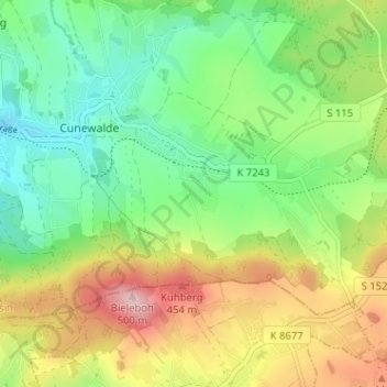
Name: Bärhäuser topographic map, elevation, terrain.

Location: Bärhäuser, Cunewalde, Bautzen, Sachsen, 02733, Deutschland (51.07168 14.51161 51.11168 14.55161)

Average elevation: 353 m

Minimum elevation: 266 m

Maximum elevation: 493 m

Gear up for your next adventure:

🧢Hiking Sun Hat - Wide-brimmed protection for exposed mountain ridges
🧼Biodegradable Camp Soap - Environmentally friendly cleaning for gear and body
🥾Trail Running Shoes - Lightweight and durable shoes for trail running
🧶550 Survival Paracord - Versatile utility cord for emergency repairs and rigging
🎒Fully Waterproof Backpack - Total protection for photography gear and electronics

As an Amazon Associate, this site earns from qualifying purchases at no extra cost to you.