Geolocate

Sambat topographic map

Click on the map to display elevation.

About this map

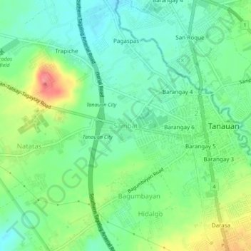
Name: Sambat topographic map, elevation, terrain.

Location: Sambat, Tanauan, Batangas, Calabarzon, 4232, Philippines (14.06542 121.11668 14.10542 121.15668)

Average elevation: 152 m

Minimum elevation: 126 m

Maximum elevation: 202 m

Gear up for your next adventure:

🥾Trail Hiking Socks - Comfortable socks to prevent blisters and fatigue
🧢Outdoor Visor - Breathable visor for sunny hikes
🧴Sunscreen SPF - Broad-spectrum sunscreen for outdoor activities
🚲MTB Frame Bag - Carry tools and maps directly on your bicycle frame
🧦Hiking Socks - Moisture-wicking and comfortable socks for long hikes

As an Amazon Associate, this site earns from qualifying purchases at no extra cost to you.