Geolocate

Chilpi topographic map

Click on the map to display elevation.

About this map

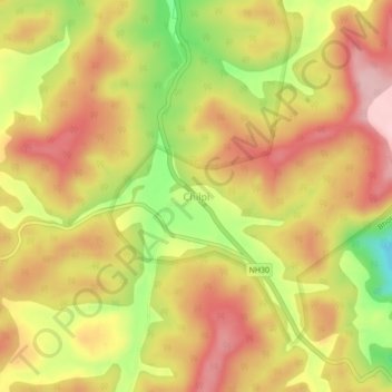
Name: Chilpi topographic map, elevation, terrain.

Location: Chilpi, Bodla Tahsil, Kabirdham District, Chhattisgarh, India (22.15218 81.03305 22.19218 81.07305)

Average elevation: 822 m

Minimum elevation: 705 m

Maximum elevation: 903 m

Gear up for your next adventure:

🏕️Camping Hammock - Integrated protection for sleeping between trees
🍽️Titanium Camping Spork - Ultralight and indestructible eating utensil
🌬️Windproof Camp Stove - Efficient cooking even on exposed mountain peaks
🌡️Emergency Mylar Blankets - Compact thermal protection for unexpected nights outdoors
🚲Handlebar Phone Mount - View topographic-map.com live while cycling

As an Amazon Associate, this site earns from qualifying purchases at no extra cost to you.