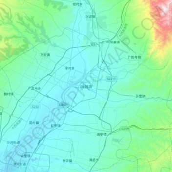
Geolocate

洪洞县 topographic map

Interactive map

Click on the map to display elevation.

About this map

Name: 洪洞县 topographic map, elevation, terrain.

Location: 洪洞县, 临汾市, 山西省, 中国 (36.09203 111.51053 36.41203 111.83053)

Average elevation: 617 m

Minimum elevation: 423 m

Maximum elevation: 2,012 m

Other topographic maps

Click on a map to view its topography, its elevation and its terrain.

南庄

中国 > 山西省 > 洪洞县

南庄, 洪洞县, 临汾市, 山西省, 中国

Average elevation: 869 m

上跑蹄村

中国 > 山西省 > 洪洞县

上跑蹄村, 洪洞县, 临汾市, 山西省, 中国

Average elevation: 676 m

师村

中国 > 山西省 > 洪洞县

师村, 洪洞县, 临汾市, 山西省, 中国

Average elevation: 754 m

王家庄

中国 > 山西省 > 洪洞县

王家庄, 洪洞县, 临汾市, 山西省, 中国

Average elevation: 1,005 m

洪安涧河

中国 > 山西省 > 洪洞县 > 洪洞县

洪安涧河, 洪洞县, 临汾市, 山西省, 中国

Average elevation: 598 m

上桥村

中国 > 山西省 > 洪洞县

上桥村, 洪洞县, 临汾市, 山西省, 中国

Average elevation: 447 m

杨曲村

中国 > 山西省 > 洪洞县

杨曲村, 洪洞县, 临汾市, 山西省, 中国

Average elevation: 444 m