Geolocate

Big Hill topographic map

Click on the map to display elevation.

About this map

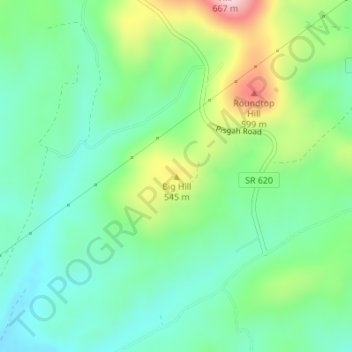
Name: Big Hill topographic map, elevation, terrain.

Location: Big Hill, Rockbridge County, Virginia, 24415, United States (37.95314 -79.32509 37.95324 -79.32499)

Average elevation: 466 m

Minimum elevation: 390 m

Maximum elevation: 636 m

Gear up for your next adventure:

🩹Moleskin Blister Pads - Direct protection for painful foot pressure points
🥾Trail Hiking Socks - Comfortable socks to prevent blisters and fatigue
🥾All-Terrain Hiking Boots - Versatile boots for varied hiking conditions
🥾Trekking Poles - Adjustable trekking poles to reduce knee stress and improve stability
🪜Heavy Duty Carabiners - Multi-use clips for securing gear to your backpack

As an Amazon Associate, this site earns from qualifying purchases at no extra cost to you.