
Thank you for supporting this site ❤️
Make a donation
Make a donation
Gear up for your next adventure:
As an Amazon Associate, this site earns from qualifying purchases at no extra cost to you.
Viadal topographic map
Click on the map to display elevation.
Thank you for supporting this site ❤️
Make a donation
Make a donation
Gear up for your next adventure:
As an Amazon Associate, this site earns from qualifying purchases at no extra cost to you.
About this map
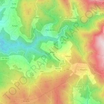
Name: Viadal topographic map, elevation, terrain.
Location: Viadal, Cepelos, Vale de Cambra, Aveiro, 4540-013, Portugal (40.82427 -8.33236 40.86427 -8.29236)
Average elevation: 674 m
Minimum elevation: 381 m
Maximum elevation: 999 m
Thank you for supporting this site ❤️
Make a donation
Make a donation
Gear up for your next adventure:
As an Amazon Associate, this site earns from qualifying purchases at no extra cost to you.