Geolocate

Lloret de Mar topographic map

Click on the map to display elevation.

About this map

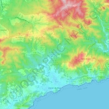
Name: Lloret de Mar topographic map, elevation, terrain.

Location: Lloret de Mar, Selva, Girona, Catalonia, 17310, Spain (41.68651 2.77686 41.76290 2.89683)

Average elevation: 125 m

Minimum elevation: 0 m

Maximum elevation: 408 m

Gear up for your next adventure:

🔋Lithium AA Batteries - Long-lasting power that performs in extreme cold
🥽Outdoor Goggles - Protective eyewear for outdoor activities
Camping Coffee Maker - Brew fresh coffee anywhere on the topographic map
🧢Outdoor Visor - Breathable visor for sunny hikes
🥾Trail Hiking Shoes - Durable shoes designed for rugged trails

As an Amazon Associate, this site earns from qualifying purchases at no extra cost to you.