Geolocate

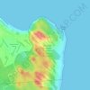
Nísia Floresta topographic map

Click on the map to display elevation.

About this map

Name: Nísia Floresta topographic map, elevation, terrain.

Location: Nísia Floresta, Rio Grande do Norte, Northeast Region, 59164-000, Brazil (-6.17379 -35.24530 -5.93398 -35.09652)

Average elevation: 43 m

Minimum elevation: -2 m

Maximum elevation: 136 m

Other topographic maps

Click on a map to view its topography, its elevation and its terrain.
Natal

Brazil > Rio Grande do Norte > Natal

Average elevation: 21 m

Morro do Careca

Brazil > Rio Grande do Norte > Natal

Average elevation: 25 m

Gear up for your next adventure:

🧦Merino Wool Socks - Moisture-wicking comfort for long-distance hiking
🧭GPS Tracker - Track your location in remote areas safely
🛰️Satellite Messenger - Emergency communication for areas with no cell service
🔋Lithium AA Batteries - Long-lasting power that performs in extreme cold
🧥Waterproof Jacket - Lightweight rain jackets for hiking and outdoor activities

As an Amazon Associate, this site earns from qualifying purchases at no extra cost to you.